SHELTER AND STORM SURGE ZONE MAPPING TOOL
Click here to go directly to the Shelter and Storm Surge Zone Mapping Tool. For more Information about this new mapping tool scroll down on this page.
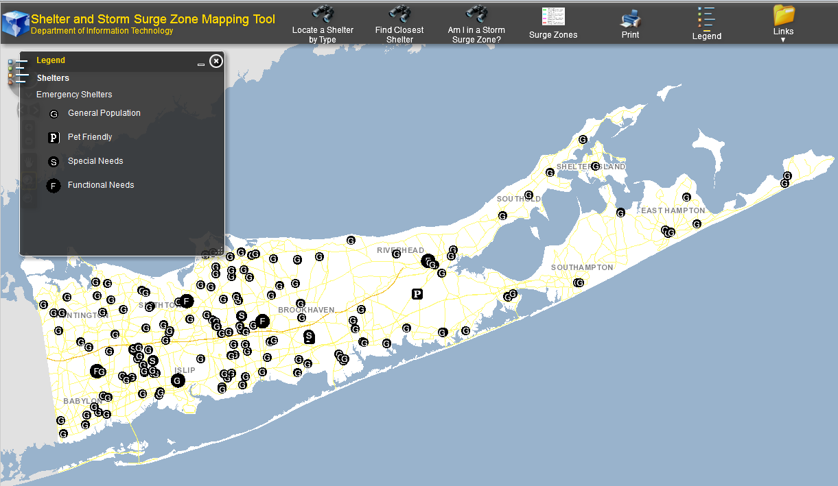
The Shelter and Storm Surge Zone Mapping Tool was developed by Suffolk County through the combined efforts of the Departments of Information Technology and Fire, Rescue and Emergency Services.
This interactive tool is provided for your information and use to assist with personal preparedness when emergency situations, storm flooding conditions or potential evacuations may occur.
The map identifies:
- address locations
- the specific types of shelters available within Suffolk County (i.e. General Population, Pet Friendly)
- the location, capabilities and pertinent information about each shelter
- which shelters are currently open in actual emergency situations
- a mapping feature for driving directions to shelters
- Storm Surge Zones showing potential flood areas from different strength hurricanes
- links to important emergency related information
Using this tool allows viewers to enter a specific address within the County and visually determine if that location is within an area subject to storm surge flooding. It also identifies the location of all potential shelters within the County. During a real emergency event, where sheltering of residents may be needed, actual conditions will dictate which shelters are open. In emergency situations, only those shelters that are open will be shown on the interactive map. Please note that the shelter closest to your residence may not be open. The mapping tool can also be used to provide viewers with directions to shelter locations.
Residents are encouraged to familiarize themselves with this emergency preparedness tool and to use it for their own planning, safety and protection.
If you determine that your home lies within a storm surge zone that has the potential to flood, you may want to make arrangements to stay with relatives or friends who live in an area that is less likely to flood, such as along the spine of Long Island near the Long Island Expressway. You should plan on going to a shelter only as a last resort.
Click here to download a PDF Map of the Storm Surge Zones in Suffolk County.